Dubai's First Mobile Waterway Survey: A Tech Leap
Klaus Schmidt ·
Listen to this article~4 min
Dubai completed the Middle East's first mobile waterway survey, creating high-precision 3D models for smart city planning. This boosts the Digital Twin project and urban development accuracy.
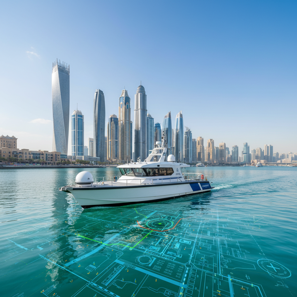
Dubai just pulled off something pretty impressive. The city's municipality completed the Middle East's first-ever mobile mapping survey of its waterways. This isn't just a fancy tech demo; it's a big step forward for how they plan and manage the city. Think of it as giving Dubai's urban planners a super-detailed, 3D map of every canal and creek.
So, what does this actually mean for the city? Well, it's all about data. By using cutting-edge surveying tech on boats, they've created incredibly accurate 3D models of places like the Dubai Water Canal in Al Jaddaf. This isn't your average GPS data. We're talking about precision down to inches, which is a game-changer for everything from flood management to designing new waterfront properties.
### Why This Matters for Smart Cities
This survey is a key piece of Dubai's larger Digital Twin project. A digital twin is basically a virtual copy of the entire city that updates in real time. By adding these waterway models, the city gets a much more complete picture. Planners can test out scenarios, like what happens if sea levels rise or how a new bridge might affect boat traffic, all without touching a single brick.
The accuracy here is what really sets it apart. Traditional methods might miss details or take forever. This new mobile system captures every curve and depth change quickly. It supports smarter decision-making for things like:
- **Infrastructure maintenance**: Spotting erosion or damage early
- **Environmental monitoring**: Tracking water quality and ecosystem health
- **Urban development**: Planning new marinas or coastal areas more efficiently
### What's Next for Dubai's Waterways
This first survey is just the beginning. The municipality has big plans to expand this project across the entire emirate. They want to create an integrated digital framework that covers all waterways, from the Dubai Creek to man-made canals. The goal is to have a complete, up-to-date map that everyone from city officials to property developers can rely on.
Imagine being a real estate professional looking at waterfront plots. Instead of relying on old surveys or guesswork, you'd have precise data on water depths, shoreline changes, and even underground utilities. That kind of clarity can save millions in project delays and design changes. It also makes Dubai more attractive for international investors who value transparency and modern infrastructure.
### The Human Side of the Tech
Here's the thing: all this tech is cool, but it's really about making life better. Better data means fewer surprises during construction. It means smarter flood defenses. It means a city that can adapt faster to challenges. For someone working in property or urban planning, this is like having a cheat sheet for the city's future.
The survey also shows how Dubai is staying ahead of the curve. Instead of waiting for problems to pop up, they're proactively mapping risks and opportunities. That forward-thinking approach is exactly why many global companies look to Dubai as a model for smart city development.
### A Quick Takeaway
If you're in the business of real estate or urban development, keep an eye on this. The data from these surveys will eventually become part of public records and planning tools. It could change how you evaluate property, plan projects, or even invest in waterfront areas. This isn't just a news item; it's a signal that Dubai is doubling down on precision and technology.
And honestly, that's a good thing for everyone involved. Whether you're a developer, an investor, or just someone who loves smart cities, this is progress you can get behind.